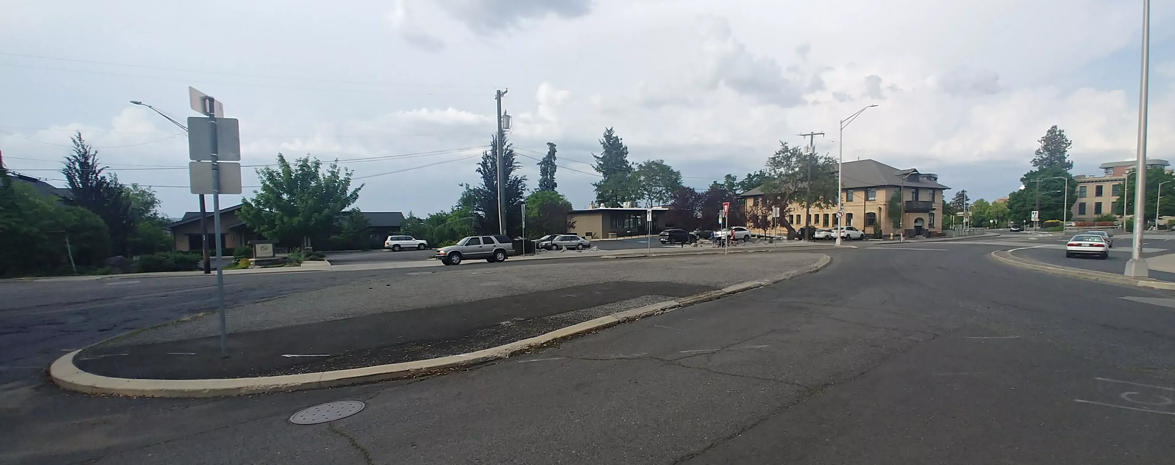
Aesthetically, it's atrocious. For pedestrians, it's confusing. And considering all the new renovations nearby, including a cobblestone pathway near Riverside and Cedar Street, and the new art-infested plaza between Sprague and First Avenue, it's almost whiplash-inducing. You go from manicured landscaping, gorgeous vistas and historic architecture to... urban wasteland.

"I used to live in Browne’s Addition," says Spokane Transit Authority spokesman Brandon Rapez-Betty says. "I just remember island hopping trying to get through there. Jumping from island to island."
City planner Dean Gunderson, city liaison to the Browne's Addition Neighborhood Council, says the islands are likely an artifact from the old way cities used to be planned.
"It’s a holdover from the 1960s and 1970s vision for how people would live in cities. Where speed was prioritized over walkability," Gunderson says. "There were a lot of really unfortunate traffic engineering solutions that were constructed after World War II, done almost completely at the expense of pedestrians and a livable downtown core."
So we've been wondering: Are there any plans to get rid of the Asphalt Archipelago?
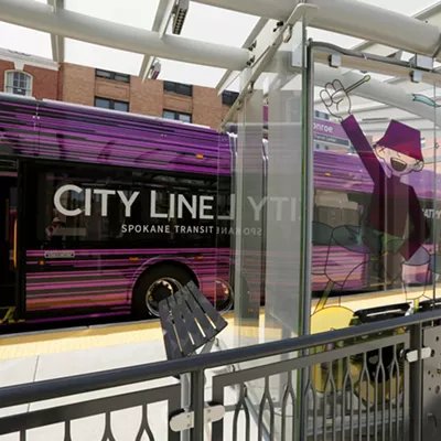
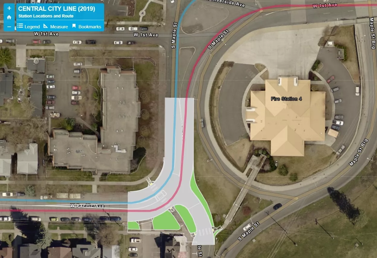
In fact, Rapez-Betty says, in early brainstorming phase for the Central City Line, the future high-frequency electric bus route between Browne's Addition and Spokane Community College, STA discussed renovating the Asphalt Archipelago.
"There were various solutions planned for the asphalt islands," Rapez-Betty says. "STA was going to be involved with the reconfigurations for all of them."
One plan, in particular, would have replaced some of the asphalt islands with a roundabout, a little like the one in front of the Elk in Browne's Addition. But as the project developed, Rapez-Betty says, that plan became unworkable. One "fatal flaw," Rapez-Betty says, was the issue of access. There was a dentist office on the north side that drivers needed to be able to get to reliably.
And ultimately, says Gunderson, renovating every asphalt island near Browne's Addition wasn't necessary. The buses could make the turn without many changes.
"The only thing that had to be touched was the intersection of Pacific and Maple," Gunderson says. So there will be some slight modifications to the ugly islands, but only near Pacific.
This map can explain it better than I can:
Rapez-Betty says that when the plan was presented to the Browne's Addition Neighborhood Council, the conversation centered more on traffic patterns and pedestrian safety than aesthetics.
Rick Biggerstaff, chair of the Browne's Addition Neighborhood Council, says that the neighborhood hasn't been focused on the asphalt islands, wanting to wait until the Central City Line was completed.
"We weren’t going to do anything at all until STA was done," Biggerstaff says.
Instead, the neighborhood's been concentrating on pushing for traffic calming measures on Second, on the north side of Rosauers. For now, he says, the city has granted the neighborhood some crosswalks to help with safety, but they're still hoping to add some more roundabouts in the neighborhood.
As for the Asphalt Archipelago?
"I think that the city will want to do something with it eventually," Biggerstaff says. But for now, the city has no clear plans.