
by Mike Corrigan
The geology of Washington state varies wildly from region to region, belying the great medley of events -- ancient and more recent, catastrophic and systematic-- that formed it. And in no part of the state is this geologic variety more evident than in Eastern Washington. We've got all the ancient igneous, sedimentary and metamorphic formations, glacial and flood deposits, flood-scoured scablands and coulees of a geology freak's paradise right here. And the story behind it all is the stuff of legend.
Dr. Gene Kiver, professor of geology at Eastern Washington University, agrees: "It's an incredible story. I mean, we've got one of the world's largest floods of water on top of one of the world's largest floods of lava -- all in the same area. It doesn't look that unique to the guy just driving over the top. But when you start realizing what it means, it gets pretty interesting."
The dominant geologic features of Eastern Washington were, for the most part, caused by two separate and massive floods -- one of fire and one of water. Approximately 16 million years ago, fractures in the Earth's crust in the southeast corner of the state began to ooze basaltic lava. These lava flows were huge, eventually filling the entire Columbia Basin from Deer Park all the way to the Pacific Ocean.
"We're talking hundreds of cubic miles of this stuff," says Kiver, who has spent years studying the surface features of Eastern Washington. "It's a rare event on the Earth. It happens, but it doesn't happen very often."
The flows pooled in the basins and lapped up against the old continental rocks to the north and east. They spread out over the landscape in layers, one on top of the next, burying the older formations under a thick blanket of basalt. Where the old buttes were high enough, the basalts flowed around them, creating islands of rock above the sea of cooling lava.
Spokane sits on the eastern edge of the Columbia basalt plateau, where the molten floods ran into the high ground of the North American Continental plate.
"Basically, we're sitting on the Rocky Mountains here," Kiver explains. "The basalts came out later. So you've got this older rock that's part of the Rocky Mountains and then you've got these lava flows covering Eastern Washington coming up against and burying the mountains. If you go up to Steptoe Butte, you're basically on an island of old rock surrounded by these incredible flood basalts."
After the basalt eruptions ceased, erosion and periods of glaciation followed. Windblown silt began to accumulate on the basalt fields, covering everything with a frosting of rich soil called loess (seen today in the fertile hills of the Palouse).
Then, about 15,000 years ago, a glacial ice dam that had blocked the Clark Fork River in Western Montana for thousands of years (creating a huge lake behind it) broke. The contents of Glacial Lake Missoula -- an estimated 500 cubic miles of water -- came roaring down out of the mountains of North Idaho, spilling through Spokane and into the Columbia Basin, stripping away the topsoil, scouring the landscape and gouging enormous coulees in the basalt before finally making its way to the Pacific. There were probably at least 40 of these floods occurring over a span of 3,000 years. The floods created most of the familiar land forms that have come to define Eastern Washington -- spectacular "dry" falls, huge, waterless coulees, perplexing basalt formations, giant ripple marks and unusual gravel bars.
Whether we were raised here or are new to the area, we all marvel at the almost otherworldly quality of this rugged terrain. Fortunately, much of it is within easy grasp. Experiencing it is as simple as grabbing a map and jumping in your vehicle. Below are four roadtrips, each one chock full of geologic significance. One trip will take you a couple of hours, the others, considerably longer, depending on your level of engagement, stamina and number of infidels along just for the ride. Where the trips get a little on the long side, I've indicated choice camping sites.
The wonders of Eastern Washington took millions (and in some cases billions) of years to form, just to impress you. How can you deny them? But first, a few spots close to home you might want to check into first.
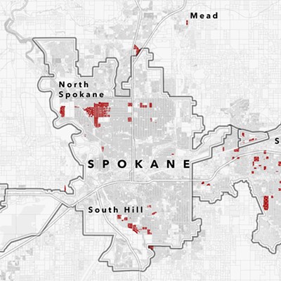
around Spokane
Spokane sits on a combination of basaltic lava flows and silt, sand and gravel deposited by glaciers and catastrophic flooding. Underneath (and sticking up here and there) are much older formations of the North American continental plate, which is primarily granite.
Housing tracts may surround the Dishman Hills (just south of Sprague Avenue between Park and Dishman-Mica roads), but this is still a great place to hike and take in the wonders of geology. Older granitic rocks of the hills rise up out of the basalt formations that cover the Spokane Valley. A trail loops through the wilderness area and contains numerous side routes that could turn a small hike into an all-day excursion.
To the west, the Bowl and Pitcher in Riverside State Park features bizarre basalt formations cut by the flowing Spokane River. Deep Creek near Seven Mile is another good place to marvel at the erosion effects of water as well as combination of basalt and much older formations.
Spectacular columnar basalt formations (formed as the basalt flows cooled slowly and evenly) can be found in the road cuts west of Spokane along I-90, Sunset Boulevard, Geiger Boulevard and Garden Springs Road. These rocks are shipped around the world for decorative purposes, but you can see them right here. Okay, scouts. Let's roadtrip...
Gardner Cave
Gardner Cave has nothing to do with molten basalt flows or catastrophic floods. These limestone caves are the happy result of millions of years of slow, steady water action through calcium carbonate-rich sedimentary rock; rock that originated on an ancient seabed 500 million years ago. As glacial meltwater gradually seeped through the porous limestone, it dissolved it in places creating huge subterranean cavities complete with stalactites and stalagmites and other unusual cave deposits.
Gardner Cave is located in Crawford State Park, North of Metaline Falls right on the Canadian border. Rangers will take you on a free tour of the cave Thursday through Monday from May until September. Starting from Spokane, take U.S. Highway 2 north to state Route 211. From there, continue north until you come to S.R. 20 along the Pend Oreille River.
At this point, you might want to take a trip across the bridge at Usk to check out Manresa Grotto, a glacially formed cave that was later used for religious ceremonies by Native Americans. Cross the bridge and continue north along Leclerc Creek Road until you come to the trail that leads to the grotto.
Back on S.R. 20, follow the Pend Oreille to S.R. 31 and continue north through Ione to Metaline. Turn on Boundary Road and go past Peewee Falls (worth a stop) and Boundary Dam (also worth a stop) to Crawford State Park.
Want to pull an overnighter? Check out the camping facilities at Crawford State Park (509-233-0321) or at beautiful Sullivan Lake across the Pend Oreille River, east of Metaline Falls.
Grand Coulee & amp; Dry Falls
The trip west from Spokane on U.S. 2 cuts through some of the most spectacular scablands, coulees and dry falls in the state. The first thing you'll notice, of course, is all the spectacular columnar joining of the basalt formations in the roadcuts just before you get to Airway Heights. Between Airway Heights and Reardan, look for giant ripple marks, the deposits of ancient floodwaters. Follow the basalt fields and Palouse loess to Wilbur, turn north on S.R. 21 and then take S.R. 174 to the engineering marvel that made human life in the region possible, the Grand Coulee Dam. Visiting the dam complex could take a couple hours at least, I'm warning you.
The dam itself is built on a granite foundation -- granite that was exposed by the floodwaters that created the channeled scablands as well as both the upper and lower Grand Coulee. The Grand Coulee began its life as a small channel cut by the Columbia River which was at one time diverted from its present course by a glacial ice dam during the end of the last ice age.
"There was another ice damn near Grand Coulee," Kiver explains. "So you've got water backing all the way up into Spokane, up to 2,200 feet or so. Then the floodwaters come in and they head down the Spokane [River] to the Columbia, but they also spill south. You'd have 200 feet of water going over us right here, and that energy -- you've got water moving at like 60 miles per hour through these channels -- cuts out a lot of material."
The force of the floodwaters spilled over the existing river channels and created huge waterfalls as the water rushed over plateaus and back down into basins. It created falls, cataracts and plunge pools that dwarf some of the largest on Earth today. Dry Falls in the lower Grand Coulee was, at its peak, a waterfall 400 feet high and four miles wide. It started at a point 25 miles downstream. As the floodwaters poured over the falls, they eroded the basalts underneath the lip causing it to repeatedly collapse, thus moving the falls upstream and leaving a giant coulee in its wake.
Says Kiver: "In the upper Grand Coulee, the migrating waterfall got all the way to the Columbia River [where the dam is today]. In the lower Grand Coulee, the water basically shut off before [Dry Falls] could cut all the way and join the upper coulee."
Today, Dry Falls is still a breathtaking sight and one of the most impressive geologic features in the state. To get there from Grand Coulee, take S.R. 155 south along Banks Lake (an artificial reservoir that fills the Upper Grand Coulee) until you hit U.S. 2, then take S.R. 17 south to the Dry Falls Interpretive Center. Along the way, be sure to stop and explore Steamboat Rock, a basaltic plateau rising 1,000 feet from the bottom of Banks Lake that survived the erosion caused by the upper coulee's retreating waterfall.
For more thrills, continue south on S.R. 17 to the Lenore Caves. This small collection of basalt caves in the side of the lower Grand Coulee was tunneled out by flood vortices. Also in the area is the incredible (but very difficult to reach) Blue Lake Rhinoceros cast in the basalt cliffs of Jasper Canyon, a lava mold of an early Miocene-period rhinoceros that was encased in molten basalts.
The best camping in this area can be found at Sun Lakes Camp Ground (509-632-5583) just south of the interpretive center, nestled in at the base of the sheer cliffs of the lower Grand Coulee right next to -- of all unlikely things -- a golf course. But there's also a campground right at Steamboat Rock (509-633-1304).
Palouse Falls and
Ginko Petrified Forest
Traveling west on I-90, you pass through amazing basalt columns, the granitic hills around Cheney and Sprague Lake (a large, flood-scoured basin). When you get to Ritzville, take S.R. 261 south through the eastern section of Lind Coulee. To the west, near the community of Roxboro, Lind Coulee contains giant ripple marks caused by current waves during the Glacial Lake Missoula floods. Continue south through the scablands and coulees past Washtucna until you get to S.R. 261. Follow S.R. 261 east until you come to Palouse Falls Road. At Palouse Falls, there is a small picnic area and an overlook where you can view the truly breathtaking falls. This time of year, the water and plunge pool -- filled with silt from the Palouse -- looks like chocolate milk. Later in the year, the water coming over the lip is clear and the pool appears green. You can hike down close to the falls, but it's a bit treacherous (a semi-perilous climb sprinkled with rattlesnakes and poison oak). Go for it.
The Lake Missoula floods diverted the ancestral Palouse River from its original western flow. Palouse Falls began as a waterfall on the north rim of the Snake River, slowly migrating north to its present location due to the floodwaters undercutting the basalt at the falls' lip. When the floodwaters receded, the Palouse River abandoned its previous path (through the Washtucna Coulee) and adopted the lower drainage created by the falls as its new route to the Snake.
Leaving Palouse Falls, retrace your steps until you get back to Washtucna. At that point, head west on S.R. 26 through coulees and loess-covered prairies to Othello. Just past Othello to the south lie the Saddle Mountains, a large ridge of basalt thrust up from the plateau by the faulting and folding of the strata beneath. When the floodwaters of Lake Missoula came thundering through the area, the Saddle Mountains stood fast as the waters were diverted to the west and the east.
Continue on SR 26 until you come to the Columbia, good old I-90 and the Vantage bridge. The Ginkgo Petrified Forest State Park Interpretive Center is just a short drive north of Vantage. Petrified wood and basalt lava flows generally don't mix (trees have a curious habit of burning when they come into contact with molten rock). Here, much to our good fortune, the ancient trees in question were waterlogged, trapped in the mud of a shallow lake. The flood basalts entombed the logs in their mudbaths and the process of petrification was allowed to commence. After millions of years of erosion (kicked into high gear by a few dozen glacial floods), the petrified forest emerged and -- viola! -- instant roadside attraction. In addition to the more than 200 petrified logs at the park is a display of Native American petroglyphs that were rescued from the cliffs below when Wanapum Dam flooded this section of the Columbia.
On the way back to Spokane on I-90, before you reach George, take exit 143 and get on Vantage Road (a section of old U.S. 10) and head back toward the Columbia to take in the spectacle of yet another flood cut cataract and coulee, Frenchman's Springs. Terrific basalt columns line the road on one side and the rugged and steep coulee drops off on the other.
Camping here is available at the Vantage KOA (509-856-2230).
Hole in the Ground
and Steptoe Butte
This is a shorty. First, take I-90 to Cheney and follow First Street through town until you come to Cheney Plaza Road. Take a left, crossing the railroad tracks and head off into the Turnbull National Wildlife Refuge. Here you will encounter -- as you will many places throughout the region -- the mysterious mima mounds (the pronunciation of which is being debated as you read this).
Correct pronunciation notwithstanding, the mima mounds are an anomaly of the Columbia Basin about which there is little consensus among geologists. Sprinkled all over the prairies of Eastern Washington, they are small, low hummocks spaced a short distance apart. What are they?
"They're silt, and they only form in certain places," says Kiver. "You've got to have thin silt and it's got to be on a hard surface like basalt. You find them all over the scablands. I had a graduate student do just the Cheney quadrangle, and I think she estimated something like 300,000 just in this area."
The mima mounds are most abundant in thin soils on top of basalt tables and seem to be concentrated in areas near the limit of glaciation. Theories attempting to explain their origin range from earthquakes to freezing and thawing of the soil to gophers.
"They're difficult to explain," admits Kiver. "Which is fine. Anyone's theory is just as good as anyone else's."
Continuing on, Cheney Plaza turns into Rock Lake Road. Take a right on Williams Lake Road and follow it until you can see a large basalt cliff to your right (there is a marsh in between the road and the cliff). This is the remnant of another flood-cut dry falls. (For a view from the top of the falls, go back and turn left on Badger Lake Road.) Go back to Rock Lake Road and continue until you come upon Miller Road. Take a left. This turns into Belsby Road and leads down into the canyon floor of Hole in the Ground, a flood-carved channel that separates Bonnie Lake (to the northeast) and Rock Lake (to the southwest), themselves impressively deep and wide basalt coulees. The sheer basalt cliffs surrounding these lakes makes access difficult (Rock Lake has one boat launch at its outlet near the community of Ewan).
Climb out of the coulee on the same dirt road and follow it through Pine City and Malden until you come out on U.S. 195. Turn south to head to the final destination on the tour, the 1,000-foot island in the middle of the Palouse, Steptoe Butte. Along the way, you'll pass the deep deposits of loess that forms the rolling hills of the Palouse, hills that narrowly escaped the catastrophic effects of the Lake Missoula floods.
Make a left at the town of Steptoe and follow the road as it spirals around the butte to the top. From here, enjoy a fantastic view of the entire region spread out before you -- the rolling hills of the Palouse, several ancient buttes sticking up through the basalt and loess and in the distance to the east, the foothills of the Northern Rocky Mountains.
These are just a few suggestions to whet your appetite for Inland Northwest rock. There are many more sights to see and geologic mysteries to decipher than can possibly fit into this puny composition. In addition, there are also many fine books that can be of great service including Hiking Washington's Geology by Babcock and Carson (the Mountaineers), Fire, Faults & amp; Floods by Meuller (University of Idaho Press) and Roadside Geology of Washington by Alt and Hyndman (Mountain Press Publishing). Also, a copy of the Washington Atlas & amp; Gazetter (DelLorme Mapping Company), a detailed topographic map of the entire state, is just about indispensable.
Now, armed with these tools and a burning curiosity to quench, isn't it time you ventured out on your own, to drink deeply from the pool of knowledge that springs only from the well of experience? I implore you: Go forth and explore.
The Inland NW rocks!
[


          {
            "name": "Broadstreet - Instory",
            "component": "25846487",
            "insertPoint": "4",
            "requiredCountToDisplay": "4"
          },{
            "name": "Broadstreet - Empower Local",
            "component": "27852456",
            "insertPoint": "8",
            "requiredCountToDisplay": "8"
          },{
            "name": "Broadstreet - Instory",
            "component": "25846487",
            "insertPoint": "12",
            "requiredCountToDisplay": "12"
          },{
            "name": "Broadstreet - Instory - 728x90 / 970x250",
            "component": "27852677",
            "insertPoint": "18",
            "requiredCountToDisplay": "18"
          },{
            "name": "Broadstreet - Instory",
            "component": "25846487",
            "insertPoint": "5th",
            "startingPoint": "23",
            "requiredCountToDisplay": "24",
            "maxInsertions": 100
          }


      ]


© 2024 Inlander
