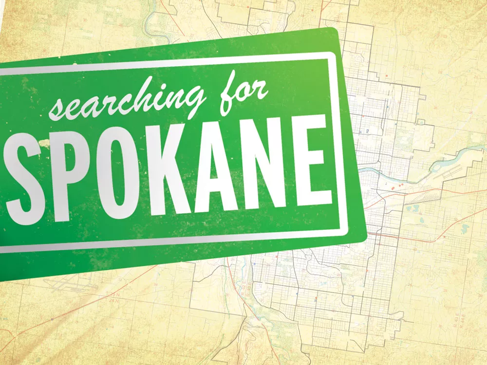

The Incredible Expanding City!
Check out our interactive graphic showing Spokane's growth — annexation by annexation — from 1881 to 2012.
It’s mid-September and I’m watching a shirtless man spray down a tree stump. It’s a big stump — seven feet across — just pulled from the ground, and Dale Barrick is really going at it, bending over to shove his arms deep into its heart, his hose showering off the dark underside and its galaxy of snarled roots.
Rivulets of sandy mud pool behind the 56-year-old Barrick and his stump. The sun shines brightly. Barrick, who wears his graying hair in a ponytail and sports a moustache, is trim and muscular, though his face is aged.
He calls me over to look down into the soggy stump. I peer in and see what he wants me to. A rock.
“Look at that rock,” he says. “The tree just grew around it.”
I’m less than an hour into my four-day, 70-mile circumnavigation of Spokane, just a few blocks past the Division Y, and I’m craning my neck to look into the shadows of an uprooted tree. The tree had grown over the years, oblivious to its surroundings. This rock, planted firmly in dirt at some point in its past, was gradually engulfed by this slow-growing Chinese Elm. Rather than move the rock, or destroy the rock, the tree swallowed it whole and made it a part of itself.
In the last 130 years, Spokane has done something similar.
 At its founding in 1881, the city began and ended in downtown. From the river to Sixth Avenue, and from Chestnut to Chandler streets, the borders of the young Spokane were determined partly by rational street grid, partly by meandering river.
But today, the shape and size of Spokane boggles the mind. Cobbled together through decades of growth, the capital of the Inland Empire is now an amorphous collage of more than 60 spurts and lurches of development. As the city grew, it swallowed new homes, new neighborhoods, businesses, hills, parks, countryside and people. And it made them all part of Spokane.
All told, what was once just a frontier outpost not much bigger than one square mile has turned into a fair-sized metropolis stretching almost 60 square miles. Zigzagging 63 miles, the city’s perimeter cuts through commercial zones, runs up forested hillsides, sails down a stretch of the Spokane River and follows streets, highways and gravel roads.
I wanted to see it all.
I set on my journey with one specific goal in mind: to travel the length of the city’s boundary — by foot, bike and boat — and meet with residents, activists, farmers, environmentalists and others to talk about how the city’s boundaries define us physically, socially, politically.
I had just a few questions. Where does Spokane begin? Where does it end? What have we become?
DAY 1: The North's Shopping Temples
It’s Wednesday afternoon, 1:13 according to my clock, and I’m impeding traffic in the parking lot of Costo on North Division. I guess a backpacked man with a map, reporter pad and camera isn’t something they normally see. Rubberneckers. I picked this Costco as my departure point — not because I wanted to load up on bulk goods, but because it’s one of the newest additions to Spokane.
It’s not much of a mystery why this tan, boxy behemoth is part of Spokane. The Issaquah-based wholesaler brings in about $1 million to the in-the-red city’s coffers, a great source of cash. In 2008, when the city took control of these 120 acres, which includes 41 businesses other than Costco, they were estimated to be worth almost $48 million.
I quickly leave the busy parking lot and try my luck on Division. Within minutes, I’m on a small strip of dirt between a traffic barrier and a chain-link fence, which separates me from a 10-foot drop and yipping dogs. The passing traffic violently rustles the tall weeds and stirs the dirt.
At close to 2 pm, I turn east off Division. Immediately, it’s quieter. This is where I run into Barrick and his stump.
“You shoulda been here Monday,” he tells me, pointing to the patches of dirt that mark where trees and shrubs once stood. He’s helping a friend renovate the place, remaking the front yard and readying the house for a new coat of paint.
Traffic roars in the near distance, and it doesn’t take much to get Barrick reminiscing.
His grandma used to live a block from here, at the intersection of Colfax and Graves roads. Back then, Spokane reached only as far north as Francis, two miles south.
Map Nick's Route
Explore the map to see the city's present-day boundaries (in red) and Nick's route around the city (in blue), and click on the icons to see pictures along the way, read Nick's blog posts and hear sound captured on-scene.
View Walking the Boundary in a larger map
“There was nothing here. Just fields,” he says, tilting his head to keep the sun out of his eyes. Now, there’s a Best Buy, Target, Borders, Starbucks, Cold Stone Creamery, Burger King and more. The great shopping temples of the north.
“She had a great big garden. She used to grow raspberries, I remember that. A lot of raspberries,” he says. “To the north was nothing.”
But nothing is no more. Neighborhoods stretch far to the north, toward Mead, Wandermere and beyond.
I leave Barrick and head east. I’ve got miles to cover before sundown.
‘Don't mess with my dog’
Wild Horse Prairie. Garlic Flats. Dogtown.
Hillyard’s been called many things, but probably the most surprising description came in 1895, when the Spokesman-Review dubbed it a “prosperous suburb” of Spokane. The bustling nexus of railyards had 486 people living around it and was able to support the proper ratio — three to six — of churches to saloons.
That same year — the year before the U.S. Supreme Court upheld the “separate but equal” doctrine in Plessy v. Ferguson — Hillyard became its own town.
Despite this, Hillyard has since been given the opposite treatment: not separate from, and definitely not equal to, Spokane.
The need for labor and the cheap housing drew immigrants to Hillyards’ railyards. Italian produce stands proliferated, and the Japanese-run Hillyard Laundry kept the neighborhood’s garments clean. To this day, with houses half the price of what they are in other parts of the city, Russian and Korean immigrants still feel the pull of Dogtown. In 1924, the ‘burb of Hillyard was still prosperous, but Spokane was nipping at its toes. By a slim vote, Hillyard unincorporated and was absorbed by Spokane.
“Hillyard gets a bad rap,” says Kevin Nunn, stating the obvious at the Big Sky Tavern, where I had come to slake my thirst after five hours of city walking. Nunn came to Spokane from his native Midwest because of the Air Force, which he left in 2006 after six years as a survival instructor. Still, Nunn loves it here and doesn’t plan on leaving. “I’ll never move past Francis, I’ll never move past Sprague.”
Nunn and his compatriots at the bar are friendly, though Nunn points out they knew I wasn’t from ’round here. “You must want something or you must be lost,” he says with a laugh. They like living in Spokane, but only because of Hillyard.
Earlier in the day, I met Leonard Tanner, who feels a bit differently about living in the city.
Tanner lives across the street from Arlington Elementary School, and he’s moving the sprinkler on his lawn when I walk up. The sun is still blazing, and Tanner is wearing a Ford Racing camouflage hat and a Brooks and Dunn T-shirt. Stubble covers his chin.
I tell him what I’m up to and he tells me he only recently bought his house, just four months ago, and he gives me an explanation I had already come to expect: He wanted acreage, and he hated paying the city for sewer, water and garbage.
Tanner, who’s driven a truck for Pacific Steel and Recycling for 15 years, comes home from work covered in “blood and salt and shit” most nights. He just wanted some peace quiet in the evenings and room for his horse.
I thank him for his time and am about to move along when he stops me.
“You remember that Poss kid?” he asks, and I do. Jason Poss was the young man shot and killed by Spokane police in the summer of 2009.
It was Tanner’s wife who found Poss standing in their dining room, holding a butcher knife. His eyes were unblinking and wide as the moon. She ran and Poss followed. When she tried to jump over the fence, it broke and Poss beat her with a skateboard. She escaped and Tanner’s young black dog, a pitbull named Molly, approached him.
“She was just saying, ‘Hi,’” Tanner says about Molly. “She probably thought he was going to play with her.” Instead, Poss stabbed her in the back.
“It nicked her intestines and almost came out the inside of her leg,” he says, recounting her luck in surviving. Molly wasn’t found for six hours, some eight blocks away. Tanner paid $2,400 in vet bills.
“You can mess with me and you can mess with my truck,” Tanners says. “Just don’t mess with my dog.”
So there’s his other reason for moving just outside of city limits.
Back in Hillyard, I polish off a few pints of beer, and watch the sky darken from my perch out on the beautiful, grassy patio behind the tavern.
DAY 2: The Wall
Beginning at 7:30 am, I go from Hillyard to Greenfield Estates, up a hill past the Beacon Hill Events facility and up another hill — this one made of sandy dirt — to the Fancher Memorial Airway Beacon, which sits on the crest of a hill overlooking Minnehaha Park, the river, Felts Field and all of Spokane.
 The rain pitter-patters up here, its quiet drops accompanying the sizzling powerlines overhead. In the distance, the sound of gunshots crack through the air — surely from the Spokane Police Department’s training facility far below.
I race down the dirt trails on my beaten 1972 Nishiki road bike and, finally back on pavement, I take Havana to Upriver Drive, pumping my pedals as hard as I can. Taking a break near Camp Sekani, I watch a floating orange bubble — marking the presence of a scuba diver — bob in the river.
After crossing the river at Argonne Road, I zigzag toward Felts Field, where I scarf a sustaining lunch of coffee and fried fish. I try my damnedest to convince a pilot to take me for a ride, but no dice.
Again on the road, I’m on Havana Street. The Wall.
“The Havana Wall,” Susan Winchell, director of the county’s boundary review board, tells me later. “When the city wanted to extend sewer and water to the Yardley area, which is east of Havana, people came to testify. ‘We don’t want to be annexed.’ We told them that wasn’t happening, it was a whole different process. But they said, ‘The Havana Wall — the city promised us they wouldn’t go east of it.’”
To the west of Havana sits Spokane. To its east, the Valley. Between Trent and Sprague Avenues, two types of law enforcement can be seen. The SPD patrols the west side of the street. The Sheriff’s Office, which provides policing for the Valley, takes the east.
It’s the beginning and end of two cities, though don’t ask me to tell the difference. Late, I rush up the hill to 37th Avenue and Havana, then head east out of town, up 44th to the Glenrose neighborhood. All said, this last leg beginning at Sprague and Havana to Glenrose, I bike six miles and gain almost 900 feet in elevation.
As I slowly roll into Sally Reynolds’ driveway, my clothes are soaked and I greedily slurp the can of Coca-Cola she gives me.
I’m sitting in Reynolds’ dining room with her and Peter Ice, both past presidents of the Glenrose Community Association. According to its mission statement, the association aims to “preserve the rural character and open space of the Glenrose Community.” Which is what neighbors Reynolds and Ice want to talk about.
Reynolds moved onto her 10-acre plot in 1973. “When we moved here, there were three homes above us,” she told me. “Now there are 30.”
Ice moved into the neighborhood just six years ago. In that time, he’s already watched developments — such as Trickle Creek, Broadmoor Estates and South Ridge — encroach into his quiet countryside.
“Glenrose would be an ideal candidate to take out of urban reserve,” Ice says. “Houses are on these five-acre, 10-acre, 20-acre parcels, it’s not really suitable for urban growth. … You have a few little areas [of dense development], but not enough that they would want to bring city water, sewer and all that. I think with a little effort, we can reverse this.”
Steve Davenport, a senior planner for the county, says the future of Glenrose has yet to be decided.
“There’s a group of residents out there who want to maintain [their way of life in Glenrose] and they’ve been largely successful,” he tells me later.
If the “cluster developments” continue to eat Glenrose, it wouldn’t be the first time a growing Spokane has edged out of its boundaries in this part of town. Indeed, this corner of Spokane looks like the searching pseudopod of a lost amoeba, shaped and twisted by the city’s various growth spurts.
“The developments that have occurred out there had been provided for by city services,” Davenport, the county planner, says. Water and sewer service were piped in by the city to all of the developments near Glenrose, he adds. When they agreed to the city’s amenities, the city made them sign a waiver saying they wouldn’t protest any future annexation by the city, something it does when it provides services outside its boundaries. Later, of course, annexation occurred. Sixteen times, to be precise.
I leave Reynolds’ home and race to Ben Burr Park, at the corner of 44th and Havana, the old city limits up until 1979. Young children squeal on the playground while their older siblings drill on an improvised soccer field. Suburban parents watch over them all, and the sounds of the park are just about the warmest thing I can imagine.
Families like these are edging in on Glenrose, taking advantage of the county’s goal to provide affordable — and therefore abundant — housing (which the city later inherits). It’s hard to fault a young family for wanting a place of its own. But it’s equally difficult to justify building over the tranquility of Glenrose, where moose are still seen, and which is just a hill away from our region’s breadbasket, the Palouse.
I leave, planning to camp in Hangman Park, in the woods of Latah Valley. I need my sleep — tomorrow I’m hitting some whitewater.
 DAY 3: ‘All the way to the falls’
Bart Mihailovich became the Spokane Riverkeeper in July. Young and amiable, Mihailovich was added to the organization next to Rick Eichstaedt, who still acts as the group’s legal mind.
But as the Riverkeeper, Mihailovich is its public face. He’s the advocate and educator for all issues surrounding the Spokane River.
I arrive in Peaceful Valley at noon, eat my bag lunch and watch Mihailovich and his father-in-law, Jim Horn, roll up with the Riverkeeper’s raft in tow. We unload the beast and begin our float. I’m very thankful: My legs feel like they’re filled with sand. I just rode up and down the hills in the southwest part of the city trying to find an elusive stretch of city limits, which wasn’t determined by natural or artificial landmarks — it’s just a line on the map.
“Salmon used to go all the way to the falls,” Mihailovich tells me from his perch on the raft’s throne, wielding two giant oars. “Their demise began with [the dam at] Nine Mile Falls. Then [the] Grand Coulee [Dam] finished them off.”
The river forms about 10 percent of the city’s boundary, from the Downriver Golf Course to the point where Seven Mile Road crosses the river. It’s a natural boundary, an obvious impediment to a city’s growth.
But I’m more interested in what it means for the river.
“It’s all stormwater run-off,” he says. Having hundreds of thousands of people live in one river’s watershed can be a strain.
“It’s not their fault,” he adds, talking about city residents. “It’s the city’s antiquated system.”
We fall into silence as a blue heron glides above. Mihailovich then points to a pipe jutting into the river, marked by a sign with a trout on it that says, “Warning!”
When it rains enough, just a quarter of an inch or more, stormwater and sewage flow from these pipes into this wild-seeming river. The city’s website has a real-time monitor that shows which of the 26 pipes are dumping their offal into the river. He assures me the rain today wasn’t enough, but I’m still sickened.
The city is currently separating sewage from stormwater. More than 50 percent of the separation is complete, but there’s still 400 miles of combined sewers left to fix. That’s intended to be complete in 2017, and at that point all of our sewage will be made clean — before being dumped in the river.
We pull the raft ashore at the T.J. Meenach Bridge and I set out alone on foot through Riverside State Park. Halfway through my walk, I hear the torrents of pounding water. Peering between trees, I see a white waterfall tumbling into the river.
It’s coming from the bowels of a white sheet-metal building — the sewage treatment plant (officially known as the Riverside Park Water Reclamation Facility). It doesn’t smell like woods anymore, but it doesn’t smell like shit either. It’s a chemical scent, like chlorine.
The cataract is a good 10 feet wide, rushing down the hillside and creating a broad eddy of bubbles on the river’s surface. When a Spokanite flushes a toilet, it ends here, briefly disrupting the peace of an urban wildland.
DAY 4: Fading Prairie
Two park rangers on horseback disappear into the woods near Bowl and Pitcher. It’s Saturday, the final day of my trip, and clouds cover the sky. I’m readying to disembark once again on my trusty two-wheeled steed. I have 16 miles of riding ahead of me, part of it up a steep, sandy hillside to the top of Five Mile Prairie.
 I reach the plateau on Strong Road and, on cue, the clouds break to reveal blue sky. Racing along, I pass by productive fields and fenced subdivisions. I blow by a fruit stand and hit the brakes. I need a carton of blackberries.
The stand is owned by Don and Doris Farmer, who’ve been married 46 years and farming these seven acres since 1973.
As I munch on my berries, the Farmers tell me about the dramatic changes they’ve seen since living on Five Mile.
“Too much traffic, but it helps,” Don says, figuring around 50 people stop by every day to buy their wares. He doesn’t see an end to what’s already begun here. “Problem is, it’s such good agricultural land up here, I’d hate to see it go to houses.”
Davenport, the county planner, agrees with Don’s view of the inevitable. “There’s a point in the future, probably not in the near future, where it will all be developed to urban densities,” he told me about Five Mile.
As we’re talking, the Farmers’ neighbor, Elmer Dunham, walks up.
Dunham’s lived up here with his wife, Betty, since 1961, when he bought the J.F. Strong House, the oldest house in the county. Built in 1879 on a 160-acre homestead, Dunham bought it and two acres for just $11,000.
“When we moved up here, it was all farmland,” the 90-year-old Dunham says. Like Farmer, Dunham laments what’s happening to Five Mile.
“But I can’t really say anything, ’cause I was a builder,” he says, noting that he was a carpenter with a firm that built 20 to 50 houses every year throughout Spokane’s north side. But you can see it in his eyes: the longing for something that’s quickly fading.
“The kids had every type of animal up here: sheep, horses,” he says. “They just had a ball. I did, too.
“Times change. Progress happens. Things were bound to change,” he says, pausing. “Those times are gone. We have to accept that.”
On my ride back to Costco, completing my 97-hour sojourn, I’m struck by the sharp contrast of dense new developments and the abutting fields. I remember Doris Farmer telling me while I grazed at her fruit stand about the pheasants she feeds, and the quail and deer that wander their fields.
And I realize Spokane, unlike Barrick’s stump, will eat this prairie and not only absorb it, but conquer and destroy it. Five Mile Prairie will become another extension of the city. The grasslands paved over and lived upon, it won’t be a prairie anymore. Just one more Spokane neighborhood.
But without growth, is a city even alive anymore? In the rush of north side traffic, I remember one more thing Doris and I talked about. More traffic means more customers. With everything bad, it seems, comes good.